Fresh satellite images of the area in Taganrog, where the A-50 plane was parked, show the blackened roof of the hangar next to the aircraft parking lot. The plane disappeared from the place of deployment - the parking lot near the hangar, which could be attacked by drones on the night of March 9, was empty.
What can be seen on satellite images of the airfield in Taganrog
The investigator published two images from Taganrog. The coordinates of the shooting point are indicated on the first photo — 47.19963, 38.86614. Russian planes are standing 100 m from this point, and there is empty space between them.
The second image is a zoomed-in previous photo of the OSINT investigator. The author of the post claims that the roof of the hangar was blackened by the fire. On this basis, he explains that on the night of March 9, Ukrainian drones flew exactly here to target the A-50.
What is known about the attack on Taganrog
On the night of March 9, the Russian Federation came under a massive drone attack. According to the data of the Ministry of Defense of Russia, military facilities on the territory of the aggressor country were attacked by 47 aircraft with explosives. Of them, 41 were headed specifically to the Rostov region, where the city of Taganrog is located.
Based on video and photos from the scene of events in Taganrog, the OSINT investigator established that at least one explosion occurred 900 m from the airfield where the DRLV A-50 aircraft was stationed. The place of deployment belongs to the Taganrog Aviation Scientific and Technical Complex named after H. M. Beriev (TANTK named after Beriev), which was engaged in aircraft repair.
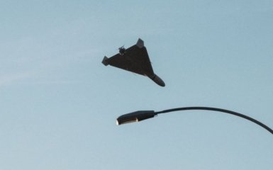
In addition, Defense Express experts stated that the "Lyuty" drone could have been used to attack the facilities in Taganrog. Only a reduced model of the drone appeared on the network, which, according to preliminary estimates, could fly up to 1,000 km and was multi-purpose.
Meanwhile, the appearance of the A-50 in Taganrog became known thanks to satellite images received by Radio Liberty. It was also reported that the plane had been spotted there more than once — the previous cases occurred in September 2023 and in mid-February 2024.

